↓ Skip to main content

Archaeology from Historical Aerial and Satellite Archives

Overview of attention for book
Archaeology from Historical Aerial and Satellite Archives
Springer-Verlag New York

Table of Contents

  1. Altmetric Badge
    Book Overview
  2. Altmetric Badge
    Chapter 1 A Spy in the Sky: The Potential of Historical Aerial and Satellite Photography for Archaeological Research
  3. Altmetric Badge
    Chapter 2 The Aerial Reconnaissance Archives: A Global Aerial Photographic Collection
  4. Altmetric Badge
    Chapter 3 Blitzing the Bunkers: Finding Aids – Past, Present and Future
  5. Altmetric Badge
    Chapter 4 Declassified Intelligence Satellite Photographs
  6. Altmetric Badge
    Chapter 5 First World War Aerial Photography and Medieval Landscapes: Moated Sites in Flanders
  7. Altmetric Badge
    Chapter 6 The Use of First World War Aerial Photographs by Archaeologists: A Case Study from Fromelles, Northern France
  8. Altmetric Badge
    Chapter 7 Historic Vertical Photography and Cornwall’s National Mapping Programme
  9. Altmetric Badge
    Chapter 8 The Use of Historical Aerial Photographs in Italy: Some Case Studies
  10. Altmetric Badge
    Chapter 9 A Lost Archaeological Landscape on the Lower Danube Roman Limes: The Contribution of Second World War Aerial Photographs
  11. Altmetric Badge
    Chapter 10 The Value and Significance of Historical Air Photographs for Archaeological Research: Some Examples from Central and Eastern Europe
  12. Altmetric Badge
    Chapter 11 Archaeology from Aerial Archives in Spain and Portugal: Two Examples from the Atlantic Seaboard
  13. Altmetric Badge
    Chapter 12 Soviet Period Air Photography and Archaeology of the Bronze Age in the Southern Urals of Russia
  14. Altmetric Badge
    Chapter 13 Historical Aerial Imagery in Jordan and the Wider Middle East
  15. Altmetric Badge
    Chapter 14 Archaeology from Historical Aerial and Satellite Archives
  16. Altmetric Badge
    Chapter 15 The Archaeological Exploitation of Declassified Satellite Photography in Semi-arid Environments
  17. Altmetric Badge
    Chapter 16 Uses of Declassified corona Photographs for Archaeological Survey in Armenia
  18. Altmetric Badge
    Chapter 17 Pixels, Ponds and People: Mapping Archaeological Landscapes in Cambodia Using Historical Aerial and Satellite Imagery
  19. Altmetric Badge
    Chapter 18 Integrating Aerial and Satellite Imagery: Discovering Roman Imperial Landscapes in Southern Dobrogea (Romania)
Attention for Chapter 15: The Archaeological Exploitation of Declassified Satellite Photography in Semi-arid Environments
Altmetric Badge

Readers on

mendeley
17 Mendeley
You are seeing a free-to-access but limited selection of the activity Altmetric has collected about this research output. Click here to find out more.
Chapter title
The Archaeological Exploitation of Declassified Satellite Photography in Semi-arid Environments
Chapter number 15
Book title
Archaeology from Historical Aerial and Satellite Archives
Published by
Springer New York, August 2012
DOI 10.1007/978-1-4614-4505-0_15
Book ISBNs
978-1-4614-4504-3, 978-1-4614-4505-0
Authors

Anthony R. Beck, Graham Philip

Editors

William S. Hanson, Ioana A. Oltean

Timeline

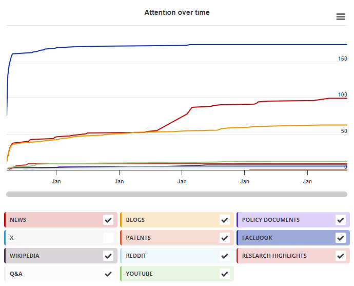
Login to access the full chart related to this output.

If you don’t have an account, click here to discover Explorer

Mendeley readers

Mendeley readers

The data shown below were compiled from readership statistics for 17 Mendeley readers of this research output. Click here to see the associated Mendeley record.

Geographical breakdown

Country Count As %
United Kingdom 2 12%
Spain 2 12%
Belgium 1 6%
Unknown 12 71%

Demographic breakdown

Readers by professional status Count As %
Researcher 7 41%
Student > Ph. D. Student 4 24%
Student > Doctoral Student 2 12%
Other 2 12%
Librarian 1 6%
Other 1 6%
Readers by discipline Count As %
Arts and Humanities 6 35%
Social Sciences 3 18%
Earth and Planetary Sciences 3 18%
Environmental Science 2 12%
Computer Science 1 6%
Other 1 6%
Unknown 1 6%